This post was originally published on 02/10/2014, with revisions taking place since then. The last revision was made on 12/16/2025.
Welcome to Transit 101! If you haven’t had a chance to read through my introductory post, please take a few moments to do so, thank you!
In this first episode, I will discuss the various ways that you can plan your public transit trip! Unlike the 1990s, where most people would have had to call their transit district or visit a customer service center, the advent of technology has made planning a transit trip so much easier! Many transit districts even allow you to purchase transit passes online, and some are now coming out with mobile apps to allow you to purchase transit passes on the go! I’ll go more in-depth into fares in a later episode.
So without further delay, let’s take a look at the ways you can easily plan your transit trip. I’ll be going through each method in detail in a moment.
- Google Maps’ Transit Option
- Smartphone Apps
- Trip Planning via Telephone
- Visiting a Customer Service Center
Google Maps’ Transit Option

My fictional character, Jeremy Riddle (above), loves to surf the web. When it comes to using public transit, the first place he goes to is Google Maps. Many transit districts have partnered with Google by providing their GTFS data, which allows customers to easily map out where they want to go, and how to get there via transit…all in one interface, and at no cost to the transit district! Some agencies provide real-time arrival information within that data as well. Below are some of the agencies that provide such information to Google.
- Hillsborough Area Regional Transit (HART) – Tampa, FL
- Pinellas Suncoast Transit Authority (PSTA) – St. Pete/Clearwater, FL
- Manatee County Area Transit (MCAT) – Bradenton, FL
- Sarasota County Area Transit (SCAT) – Sarasota, FL
- GoPasco – Pasco County, FL
- Central Florida Area Regional Transportation Authority (LYNX) – Orlando, FL
- Volusia County Transit (Votran) – Daytona Beach, FL
- Hampton Roads Transit (HRT) – Norfolk/Hampton, VA
- Chicago Transit Authority (CTA) – Chicago, IL
- Metropolitan Transportation Authority of New York (MTA) – New York City, NY
- Régie Autonome des Transports Parisiens (RATP) – Paris, France
- Public Transportation authorities in Manila, Philippines
Although Google Maps has provided a transit option for a few years now, the entire interface has been redesigned with additional features to further help you with planning your transit trip in a snap! One powerful tool is the Schedule Explorer.
Let’s take a glance at Google Maps. Click on the images for a closer look.
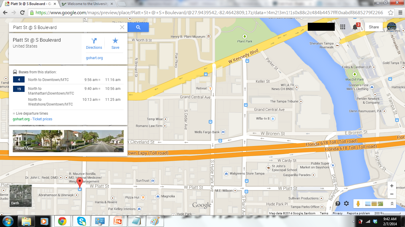
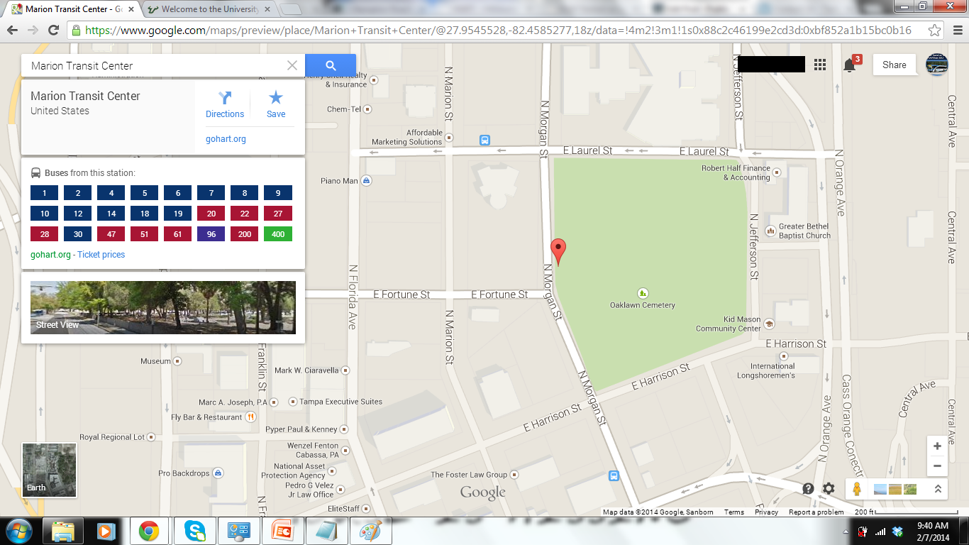
There’s a couple ways you can plan your trip with transit. You can either type in an address in the search box on the upper-left hand corner of the map, or simply select a bus stop. Bus stops are indicated by the blue “bus” logo. In transit systems that have rail services, corresponding “train” buttons will show. Please keep in mind that you have to zoom in a bit for these buttons to show.

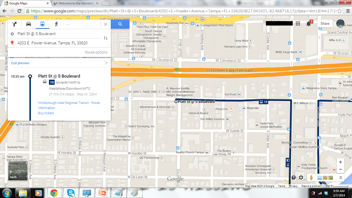
Clicking on a bus or rail stop will show you what services are available from that stop, where they terminate at, and in many cases, will show what times a particular bus or train departs from the selected location.
Now, notice the small circles next to each departure time? Those circles indicate that real-time information is available for those particular trips. HART is one of several transit districts to allow real-time GTFS data to be transmitted to Google.
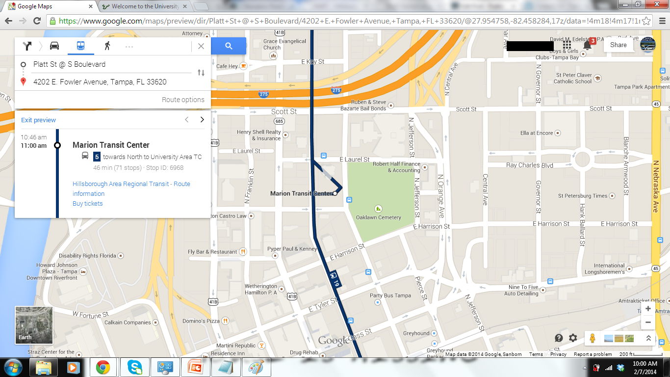
At locations that show a bunch of routes (like HART’s Marion Transit Center), you’ll see the following.
While you can select an individual route to see a departure board, there are currently limitations with the desktop version versus the smartphone app. On the smartphone app, you can filter routes so that only the route you want to view will show with its departures board. This currently cannot be done on the desktop version.
Now, let’s say you want a step-by-step guide of your transit trip. Just like turn-by-turn driving directions, Google Maps allows you to view your transit itinerary step-by-step. Simply click on a bus or rail stop button, then select the “Preview Steps” link to open up something like this…
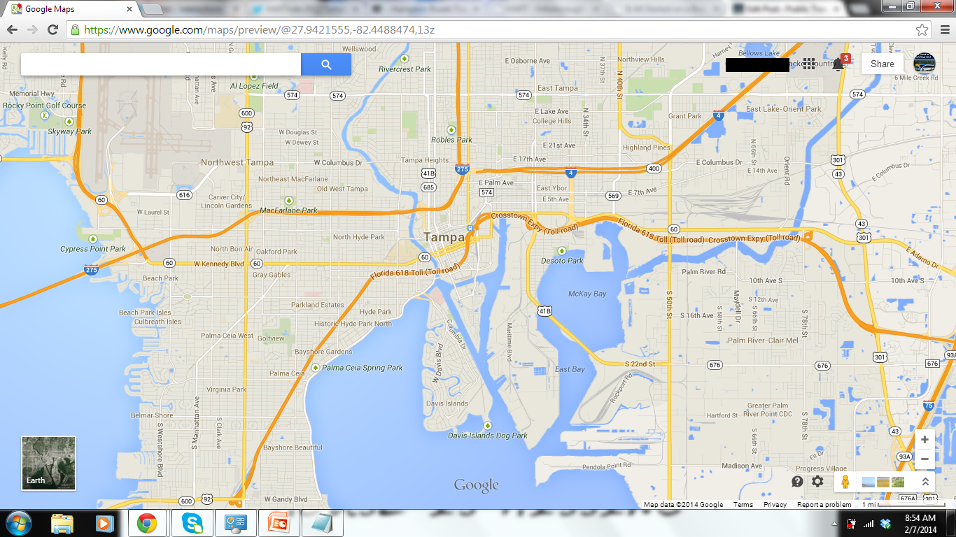
Now, let’s do a quick “to” and “from” using the search box. For this demonstration, I’ve chosen the USF Tampa Campus as my origin, and the Rivergate Tower at 400 N Ashley Dr in Downtown Tampa as my destination.
Whether you type in an address into the search box, or just select a transit stop on the map, you’ll always have the option to fetch directions to or from the selected point on the map.
Now, by default, when fetching directions to or from a particular point on the map, driving directions will be selected. You’ll want to choose the transit option bu selecting the “bus” tab. Bike and walking options are also available for those who like to walk or bike from place to place. For longer-range travel, an airplane option is available (I haven’t tried that latter option yet).
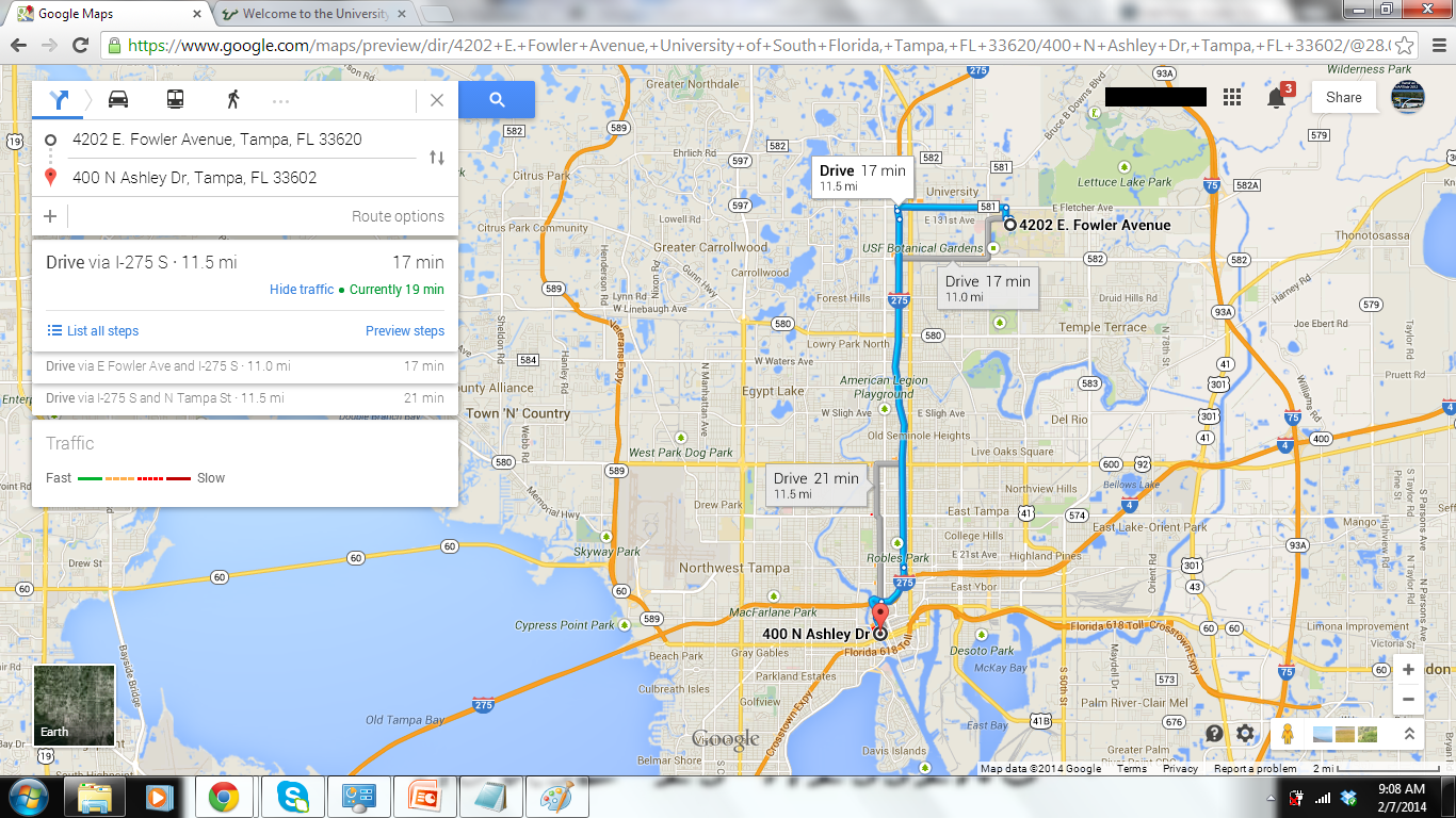
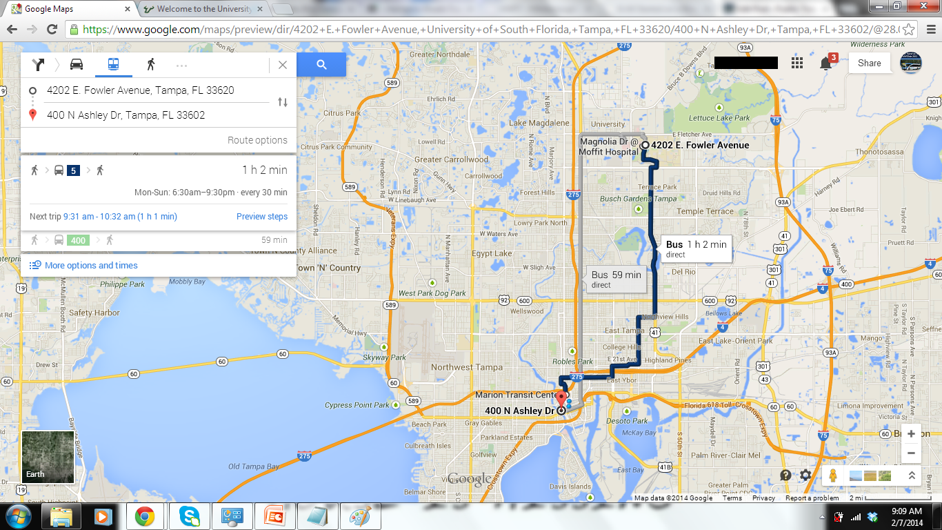
Using the transit directions option on Google Maps is pretty straightforward. Just like how Maps plots out the best route for you to take when you drive, Maps also plots out what is the best bus and/or rail route to take to your destination. Please keep in mind that several options may be available to you.
Notice the link on the bottom of the left-hand box that reads “More Options and Times”? Click on it! It will take you to the Schedule Explorer option.
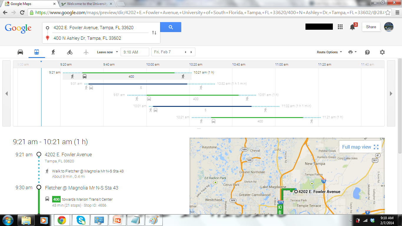
When the last major overhaul of the Google Maps desktop version occurred, the Schedule Explorer option was introduced. This allows you to customize your transit trip by entering a departure time that is best for you, then selecting which routes would best suit your travels.
While the full explorer option isn’t available on mobile, there are options available to help you refine your trip.
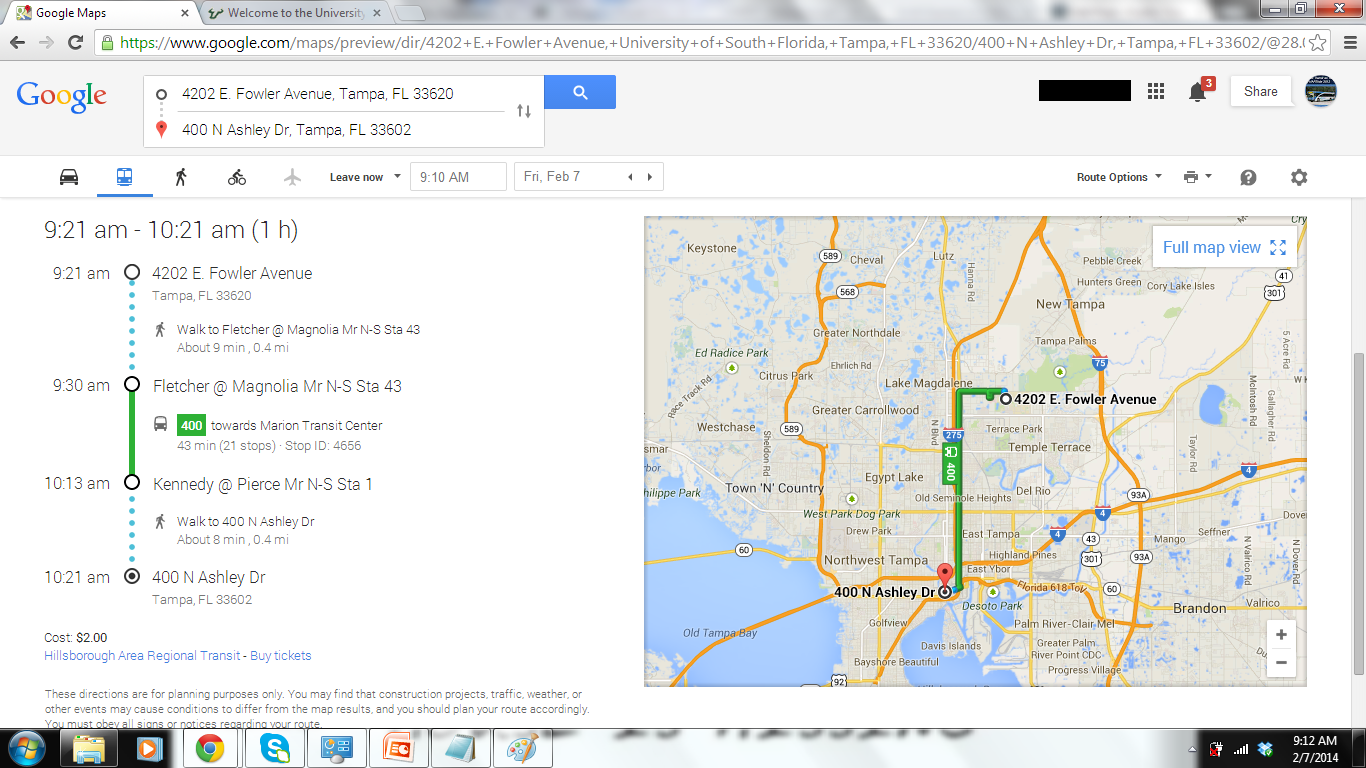
The top pane shows what routes are available to you based on the departure time and date you selected. Below this pane is step-by-step directions on getting to your destination (walking to the bus or rail stop, the routes you selected, any applicable transfers, and reaching your destination), as well as a map. To return to the map view, select the “Full Map View” button on the right.
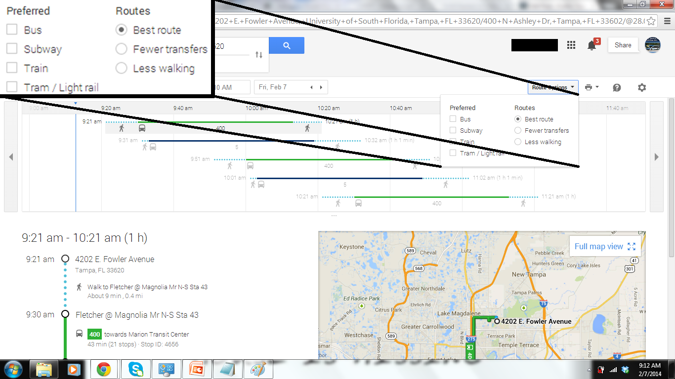
In transit districts with rail services, additional options are available by clicking the “Route Options” button below the route options pane (just above the map).
This pane allows you to further customize your trip by selecting options with the fewest transfers or least walking distance.
And that’s not all! I could probably spend hours going through the different route possibilities for the HART system alone. If you want to try things out for yourself, just head on over to Google Maps now!
Google Trip Planner module on transit district websites.

Some transit agencies have a built-in Google Maps module on their websites. In these modules, you would enter an originating and destination address, then specify the date and time that you wish to depart/arrive. You will then be directed to the Google Maps website for the results.
Smartphone Apps
With the advent of Smartphones, comes numerous apps designed to help plan and navigate your transit trip. While I will go into detail regarding Smartphone Apps in a separate post, I thought that it was important to at least mention what apps exist. Please note that these apps are created and operated by third parties and not the transit agencies themselves.
The below list was updated in 2023:
For some transit agencies, I personally like to use TransSee. TransSee is simple & easy to use, uses little bandwidth, & is friendly on mobile devices.
Trip Planning via Telephone

Although Google Maps is by far the fastest and easiest way to plan your transit trip, I understand that there are people that either don’t have access to a computer and/or the internet, as well as those who prefer to use the telephone rather than the internet. Don’t worry! Pretty much transit districts still have their telephone lines open, and they are still staffed by customer service representatives during the week. In addition, many transit districts are able to provide an automated interface (or IVR – Interactive Voice Response) through their InfoLine phone system to provide transit scheduling information 24/7!
Please keep in mind that some agencies do not staff their customer service centers on weekends or holidays. Others may have reduced hours during these days. Unforeseen circumstances will also cause agencies to reduce hours.
Visiting a Customer Service Center

Some customers would rather speak to someone in person about planning their transit trip. That’s perfectly fine! Most transit districts still provide customer service centers by which customers can pick up schedules and speak with a customer service agent face-to-face. And while hours will vary depending on the district and day of the week, most customer service centers are typically staffed at least Monday through Saturday, with some districts being able to provide Sunday and Holiday hours. Please keep in mind that some districts close down their customer service operations on some holidays like Thanksgiving.
In Conclusion
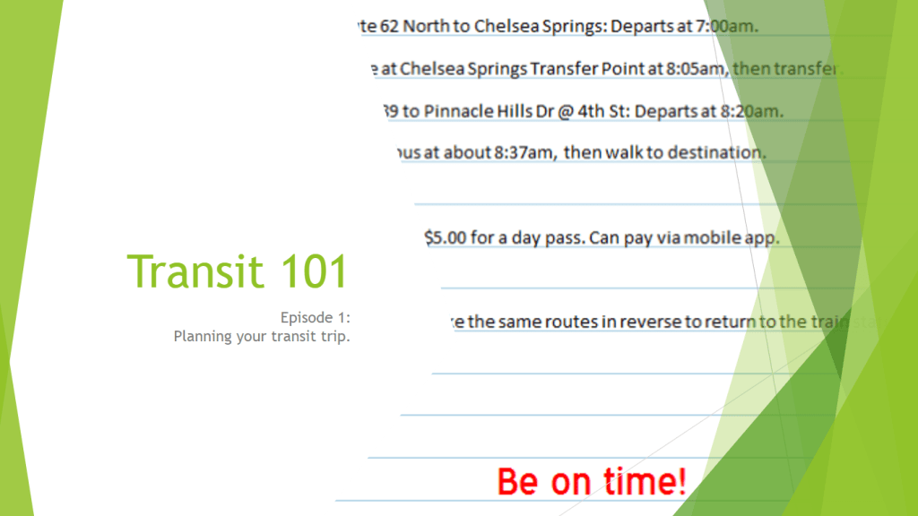
Regardless of what method you choose to to plan your transit journey, please always keep in mind to have everything planned out prior to leaving for the bus or rail stop, and always arrive at the stop at least five to ten minutes prior to the scheduled arrival time. If inclement weather should arise, please arrive at your stop at least ten to fifteen minutes prior to the scheduled arrival time.
If you happen to come across anything that is incorrect, please let me know as soon as possible and I will correct the information. I always strive to make sure everything is up to date.
Connect with the Global Transit Guidebook!
Be sure to bookmark: http://globaltransitguidebook.com

4 thoughts on “Transit 101 – Episode 1 – Planning your transit trip”