
Post was originally created on 05/15/2013 & was rewritten on 11/05/2023.
Hi everyone! I originally made this post 10 years ago & while I was initially satisfied with how I wrote it, my intentions for what was then simply known as Transit Tourism was somewhat different. The original post series was to document my travels, but I included out-of-state travels in the mix alongside in-state travels. As I thought of where things were going with the series, I eventually realized that it would be best to rebrand Transit Tourism to focus on my Florida travels & create Journeys Afar to focus on travels elsewhere around the country & beyond.
2013
April 11 – April 16
I embarked on a six-day road trip – the first completely on my own road trip – to Norfolk & Virginia Beach, VA. I mainly embarked on this trip to see family members, but I also wanted a chance to hop on the then-relatively new light rail line in Norfolk – The Tide.
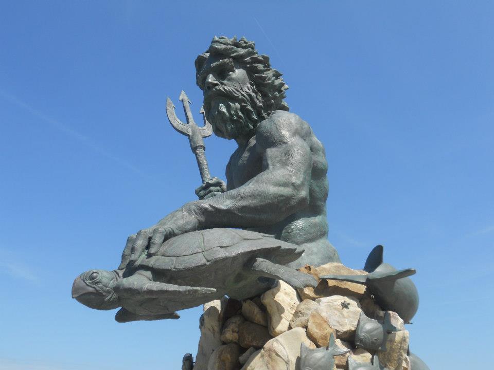
While in the Hampton Roads region, I got to visit downtown Norfolk & some of the immediate suburbs, the popular Virginia Beach Oceanfront, portions of Portsmouth & Chesapeake, & Naval Air Station Oceana.
I also made brief stops in St. Augustine, FL, Savannah, GA, & Charleston, SC.
Before delving into the revised post, let me provide some background as to how the original post was structured. The original intent of the post was to have 3 to 4 parts, with the 1st part providing an introduction to the Hampton Roads Transit system, the 2nd part honing in on my overall experience in the area, the 3rd part focusing on how the Tampa Bay region could learn from cities like Norfolk, & the 4th part looking at points of interest accessible from The Tide. While I was able to complete the 1st two parts, part 3 was never completed.
The new post structure will encompass the following:
- A brief look into the similarities & differences between Tampa & Norfolk, as well as an introduction to HRT & its services.
- St. Augustine, Savannah & approach into Hampton Roads.
- Virginia Beach & the Oceanfront.
- Downtown Norfolk & The Tide.
- Cape Henry & Oceana.
- Leaving Hampton Roads, stopping in Charleston, & heading home.
- What’s changed in Hampton Roads since my visit.
With that part being said, let’s take a quick look at the similarities & differences between Tampa & Norfolk:
Tampa, FL
- Population (2020): 384,959.
- Transit Agency: Hillsborough Transit Authority.
- # of active bus routes (2023): 34.
- Passenger Rail Service: TECOline Streetcar.
Heritage Streetcar.- Length (miles): 2.7.
- # of Stations: 11.
- Ferry Service: HART does not operate any ferry services on its own. However, an independent service – the Tampa Bay Cross-Bay-Ferry does provide seasonal service between Tampa & St. Petersburg.
Norfolk, VA
- Population (2020): 238,005.
- Transit Agency: Hampton Roads Transit.
- # of active bus routes (2023): 68.
- Passenger Rail Service: The Tide.
Modern Light Rail.- Length (miles): 7.4.
- # of Stations: 11.
- Ferry Service: Elizabeth River Ferry, connecting Norfolk & Portsmouth. Operates all year round.
As you can see above, while Norfolk itself has less population within its city boundaries than Tampa, the bus system that serves it has roughly double the number of routes operating today. Back in mid 2013, HART operated roughly 45 routes while HRT ran close to 60. This is largely due to gradual service reductions that have occurred at HART since 2010.
Despite cutbacks due to the Covid-19 pandemic, HRT has been able to gradually restore a good chunk of its service while HART has not. As with many transit agencies, both HART & HRT are unable to fully restore pre-pandemic service levels due to staffing & fleet issues.
At the height of the 1920s, Tamp & Norfolk all streetcar lines. These lines unfortunately began to vanish in the 1930s and 40s as buses became the preferred mode for public transport.
Both HART & HRT generally have routes that are more concentrated in around city or town centers, whereas suburban routes are more spread out & sporadic in nature. More emphasis has been placed in recent years on core routes that have higher ridership levels, which in HRT’s case – has brought the introduction of what is known as 757 Express service, which I’ll discuss in a little bit.
Both HART & HRT have bus routes that access a military installation.
Both HART & HRT used to operate downtown circulator services. HART once ran the Uptown-Downtown Connector & the In-Towner while HRT once ran the Norfolk Electric Transit (or NET) circulator.
Both Tampa & Norfolk are served by a limited number of Amtrak trains per day.
TAKING A GLIMPSE INTO HRT
Agency Snapshot
- Established: 1999.
The agency’s predecessors were PENTRAN (Peninsula Transportation District Commission) & Tidewater Regional Transit. PENTRAN was established in 1974 & replaced private-ran bus services in Hampton & Newport News. TRT was established in 1977 following the consolidation of several private entities into one body. - Local & Express (fixed-route) Bus, Light Rail, Ferry, Paratransit Van Service.
- Number of Fixed Bus Routes: 71 (including suspended & seasonal routes).
- Number of Revenue Vehicles: Roughly 265 fixed-route buses. At least 70 paratransit vehicles. 9 light rail vehicles. 3 ferry vessels.
- Number of Major Transit Hubs: 6.
Service Summary
HRT provides fixed-route bus & paratransit van service to the cities of Norfolk, Portsmouth, Chesapeake, Virginia Beach, Hampton, & Newport News. Bus routes also serve vital employment centers such as Naval Station Norfolk & the various military shipyard facilities located throughout the region. The Tide Light Rail Line operates within the bounds of the city of Norfolk – with planning underway for a possible extension to serve the northeastern suburbs & ultimately Naval Station Norfolk. The Elizabeth River Ferry provides passenger ferry service between Portsmouth & Norfolk to allow for a commuting alternative between the two cities.
Core local & regional express services are gradually being rolled into the new 757 Express network. The 757 Express is designed to quickly connect customers to where they need to go with a mix of frequent, reliable core local service during weekday peak commuting times & fast, comfortable regional express lines. As of November 2023, two 2 routes & 8 express routes have been integrated into the new network, though 2 express routes remain suspended due to Covid-19 impacts.
Seasonal (late spring/summer/early fall) service in around the Virginia Beach Oceanfront is provided through the Virginia Beach WAVE (or simply VB WAVE) services – which provides additional local service for residents & visitors alike through a combination of standard transit buses & replica trolley buses. There are a total of 5 routes operate during the week from Memorial Day weekend through the week of Virginia Beach’s annual Neptune Festival in October.
Until 2017, the city of Norfolk funded a circulator service in downtown called Norfolk Electric Transit (or NET). This circulator service was known for utilizing a fleet of low-emission hybrid transit buses.
HRT’s bus fleet primarily comprises of Gillig Low Floor vehicles, though the agency utilizes a smaller fleet of Hometown Manufacturing Streetcar vehicles for VB WAVE replica trolley routes & a small fleet of Nova LFS buses for Routes 44, 45, & 47 which the 44 & 45 pass through the tunnel connecting Norfolk & Portsmouth.
HRT also operates the Elizabeth River Ferry, which provides an alternative to driving over the various bridges and tunnels that cross the Elizabeth River. The ferry has three ports of call; the Waterside Ferry Dock at Norfolk’s Waterside Festival Marketplace, and the North Landing and High St Ferry Docks in Portsmouth. During sporting events at Harbor Park Stadium, a fourth port of call is set up just outside of the stadium to facilitate quick service between the stadium and the North Landing Ferry Dock. Ferry services run year-round, but service frequencies vary depending on the time of the year, etc.
From a parking lot corral to a centralized transit center

Until 2015, one of the main transfer hubs for the HRT bus system was located just outside of downtown Norfolk at Cedar Grove. The transfer hub was located in a large parking lot expanse adjacent to the Cedar Grove & Elmwood Cemeteries. The HRT Administrative Office is located just north of the lot.
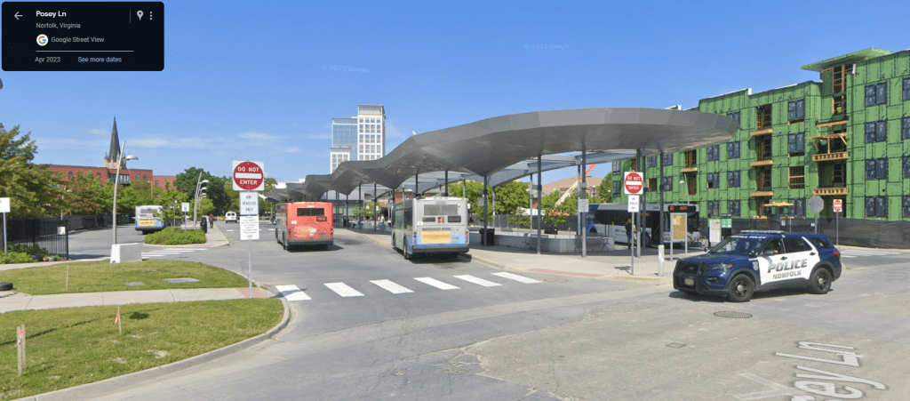
In 2015, the Downtown Norfolk Transit Center opened, located in downtown Norfolk, providing better access to venues such as the Scope Arena, as well as a shorter walk to the nearest light rail station on Monticello Ave (roughly a 2 block walk), & customer amenities such as restrooms.
The Tide rises, but not without challenges
Even though the Hampton Roads bus and ferry services provide an alternative to driving, the area’s freeways and surface streets were continuing to be clogged with traffic. Like the Tampa Bay area, the residents of Norfolk, Virginia Beach, Chesapeake, and Portsmouth knew that they needed light rail, but weren’t sure how to go about funding it. During the 1990s, a light rail line was proposed to run from Norfolk to the Virginia Beach Oceanfront via an abandoned freight rail line once operated by Norfolk Southern.
In 1999, a transit referendum similar to that of Tampa/Hillsborough County’s referendum in 2010 was presented to voters of Virginia Beach. Unfortunately, voters struck down the referendum and passed their own resolution to not be involved with the planning of light rail for ten years. From that point onward, the city of Norfolk decided to continue plans for a light rail line without Virginia Beach’s involvement.
With rising gas prices and clogged highways, discussion about light rail resurfaced during the course of 2008. The city of Norfolk was determined to bring their light rail plan to fruition by utilizing a portion of the freight rail corridor while remaining within their city limits. This plan would evolve to what is now known as The Tide.
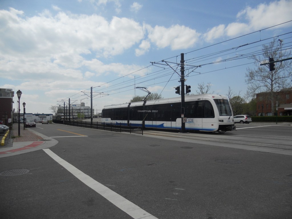
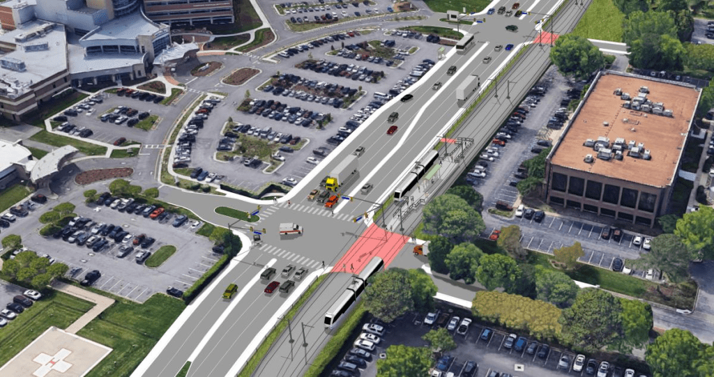
A detailed look at The Tide
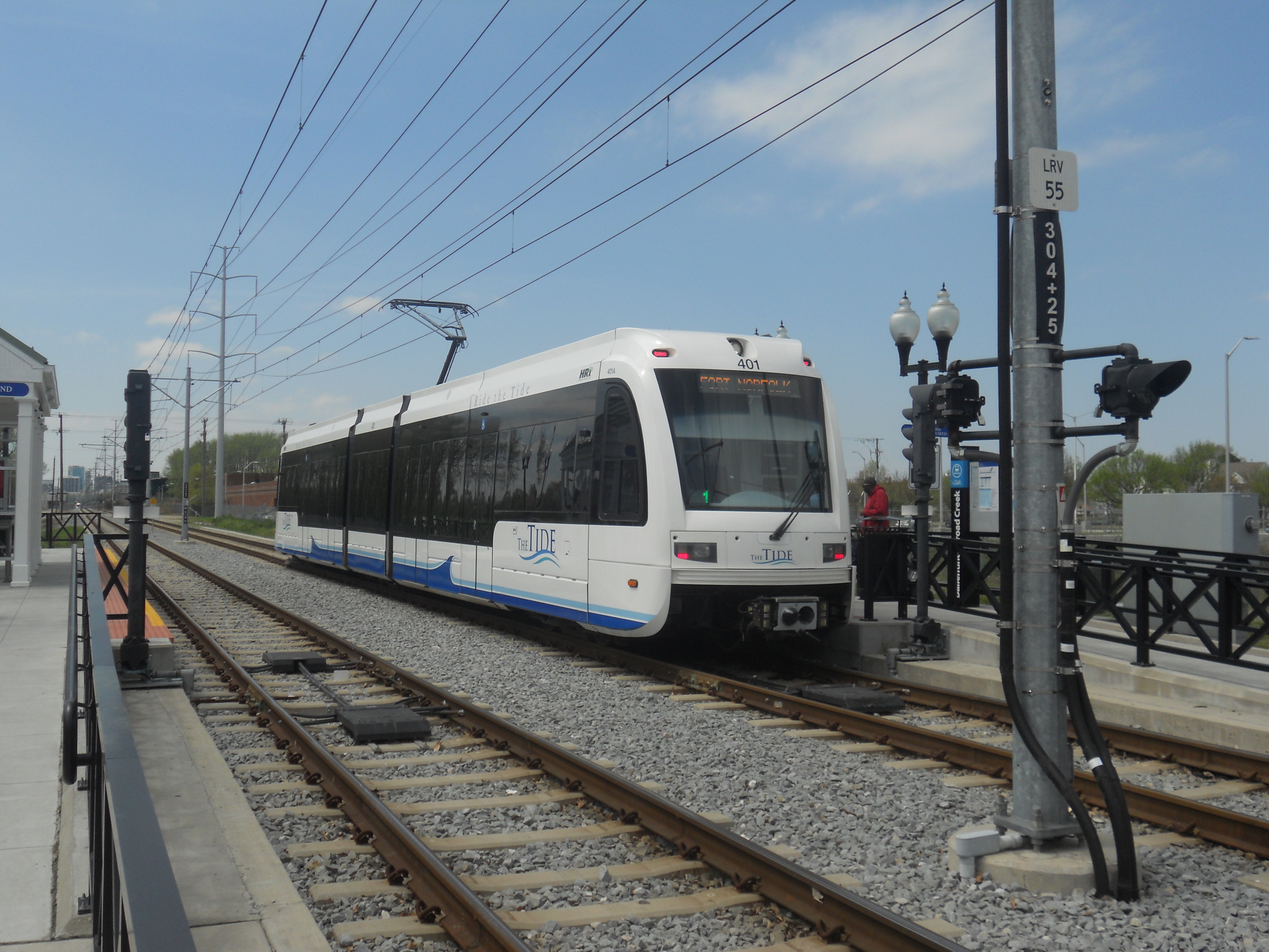
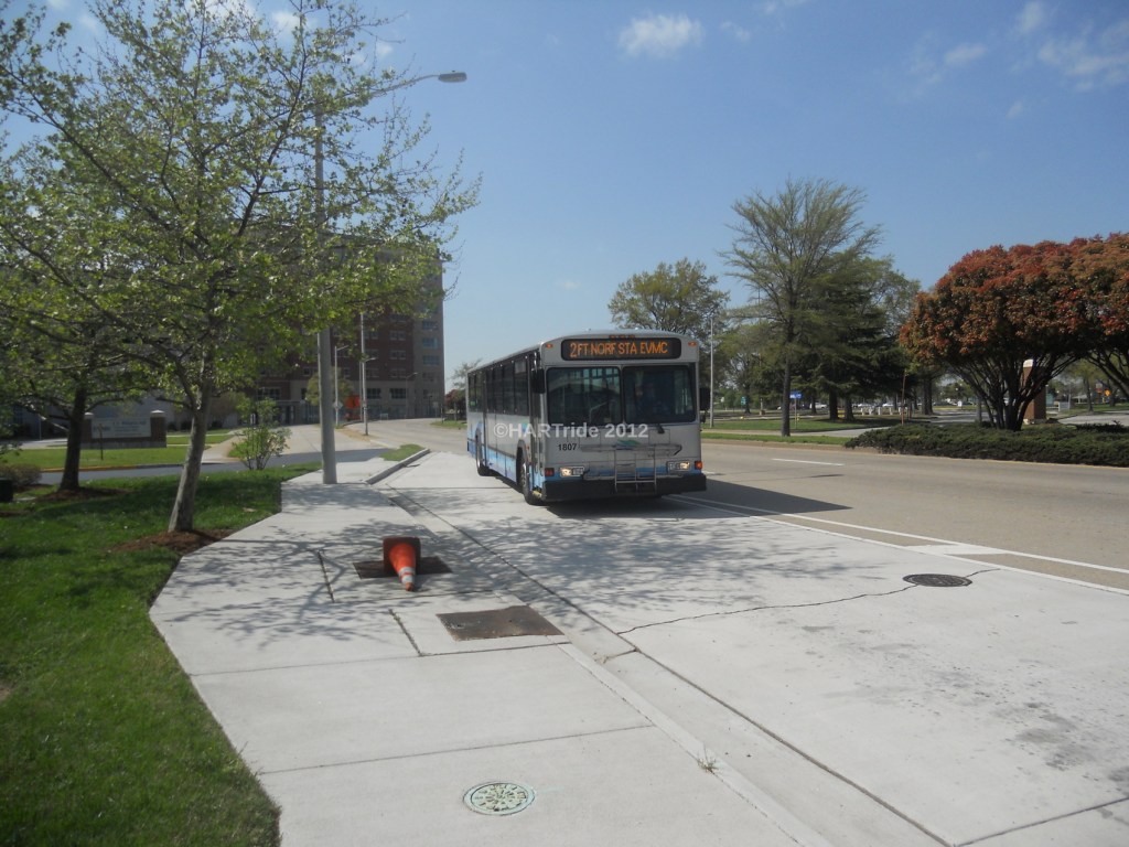
The Tide is the first light rail line to be constructed in the state of Virginia, opening to passengers on August 19, 2011. It offers service from the southern fringe of downtown Norfolk to eastern fringe of the city (at Newtown Rd) and provides direct connections to 20 local bus routes and three express bus routes from the station platforms. The entire line spans 7.4 miles and is double-tracked for the entire length, with exception to the terminating stations. In addition; park-n-ride lots are provided at four of the line’s eleven stations to allow commuters and visitors to easily travel to and from downtown Norfolk.
The downtown Norfolk section (between Botetourt St and Park Ave) meanders through city streets and as a result, trains must follow traffic signals to allow vehicular traffic to flow smoothly. When all of the traffic signals turn red, and all vehicular traffic has stopped, the train will be allowed to continue its journey.
The rolling stock used on The Tide comprise of 9 Siemens S70 LRV trains, similar to trains that are used on the LYNX Blue Line LRT in Charlotte, NC. Service frequency on The Tide varies by time of day and day of the week. Weekday peak service currently has trains running every ten minutes, with trains running every 15 minutes during non-peak daytime hours. 30 minute frequency occurs during the late-evening hours, Monday through Saturday.
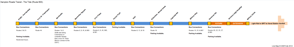
Here is the listing of all of the line’s current stations:
- Eastern Virginia Medical Center (EVMC)/Fort Norfolk
- York St/Freemason
- Montecello
- MacArthur Square
- Civic Plaza
- Harbor Park
- Norfolk State University (NSU)
- Ballentine/Broad Creek
- Ingleside Rd
- Military Hwy
- Newtown Rd
The station names chosen relate to either the roadway by which the station sits at, or a nearby landmark. This naming convention sits in line with what most rail systems throughout the world use. All of the station platforms include traditional style shelters, ticket vending machines, and information boards (containing transit maps, information, and feeder bus schedules). Four stations (Monticello, Civic Plaza, Harbor Park, and NSU) are island platforms, while the rest comprise of two outer platforms (one on each side of the track).
Potential extensions
Ever since the opening of the original line, efforts to extend the line have been among the top transportation priorities for the entire Southside region. However, subsequent attempts to get the Tide extended to Virginia Beach have also failed, resulting in HRT to re-align its efforts towards eventually getting light rail up to Naval Station Norfolk. The current plan encompasses a spur line to connect to Military Circle Mall – which is pending redevelopment. From there, options exist to eventually connect the spur over to Naval Station Norfolk, though BRT is being explored as a near-term option. An earlier study to extend the line to the naval base from the existing line’s western terminus was deemed to be too difficult to execute & was ultimately abandoned.
Source
Wrapping up for now
You can visit the HRT website for the latest information regarding up to date schedules & plans to extend The Tide. I’ll be rebuilding my HRT section in the coming months, as well as slowly complete the Journeys Afar series on Hampton Roads. In the meantime, please feel free to check out other parts of The Global Transit Guidebook & let me know what you think.
Connect with the Global Transit Guidebook!
Be sure to bookmark: http://globaltransitguidebook.com

First off, great post. Looking forward to the 2nd and 3rd installments.
I did have a few questions for you about HRT and your experience there. (If you’re going to cover some or all of this in the next installment, I’ll wait to find out.)
-Did you get a chance to ride an Optima Opus? If so, what did you think of it?
-You mentioned that there were TVM’s located at each station on The Tide. Did you ever see some sort of fare enforcement (i.e., turnstiles, “proof-of-payment,” etc) in effect?
-You note that both HART and HRT run a similar amount of bus routes. In the case of HART, the grid network (technically a “spiderweb” network) has been designed to allow for transfers at route intersections. HRT in turn appears to have a network that is largely hub-and-spoke, with some of their routes appearing to be extremely circuitous. Does this work for the Hampton Roads area, or is there a need for a change?
Thank you very much Zac! I’m glad that you enjoyed reading this post!
Here are the answers to your questions:
1) No, I did not have an opportunity to ride (nor did I see) an Optima Opus bus. My understanding was that there are a few of these buses still in the fleet, but I am not sure for how much longer. In fact, you can find a listing of their active vehicles on the HRT website (http://www.gohrt.com/hrt-public-records/operations-documents/) titled “Current Fleet Inventory”, and I did not see any Optima vehicles listed, which makes me wonder if those buses were already phased out.
2) The Tide operates on an honor system. HRT expects that you’ve paid your required fare when you board the train. However, there are periodic ticket inspections, which is the case onboard many commuter rail lines throughout the world, so you always need to make sure that you have your ticket with you at all times. Otherwise, you face a fine of $250.00 (unless that has gone up recently).
3) Yes, both HART and HRT (and even PSTA) operate on some form of a hub-spoke system, though HART seems to be more of a spider web like you mentioned. From what I’ve read on the HRT website (http://gohrt.com/about/), HRT actually contracts with each municipality to provide transit service and each municipality in-turn directs HRT as to how much transit service it can provide to the area. I’m sure that this plays a role in how routes are shaped (in addition to of course employment centers, density, etc.) I strongly believe that the current setup is somewhat inefficient due to some areas not being well served in comparison to others, and I do feel that many changes can be made to the system, but like HART and PSTA, there is currently no additional funding to make drastic improvements.
I will be going more in-depth about my experience in the 2nd installment.