Post Updated on November 11, 2013.
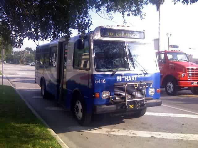
HART’s Route 46 has undergone many changes throughout the years. Back when it was first implemented, the route only served the Port of Tampa/Hookers Point and Davis Island (comprising of two loops on either end). As more service towards Brandon was needed, Route 46 began to extend along Causeway Blvd towards Westfield Brandon Mall. Along with the extension though, service through the Davis Islands was faltering. HART eventually made cutbacks to Davis Island service and for a while, even eliminating midday trips.

With demand increasing, and funds being available again, HART will be restoring midday service to Route 46 during its November, 2013 markup. Additionally, HART is now proposing that the Davis Island segment be eliminated in favor of an eastern extension towards the Dover Park-N-Ride Lot off State Road 60 (currently served by Route 22X). If the latter change goes through, the western terminus of Route 46 would shift to the Marion Transit Center in downtown Tampa.
Why I think the routing change is needed.
Although the Davis Islands does need to continue being served by public transit, I strongly think that the best course of action would be for HART to implement a HARTflex zone throughout the entire island. I don’t think that ridership is strong enough to keep fixed-route buses rolling through the island. However, I also don’t think that the island should be deprived of transit altogether, since transit does provide an alternate form of transportation. Implementing a HARTflex zone would bring balance to the islands, while maintaining basic transit services. Please note that the only exception to the rule is HART Route 19, which provides frequent service to Tampa General Hospital. Any change to Route 46 would likely not have any impact on Route 19.
To illustrate these changes, I’ve created two Google Maps; the first one illustrates the changes being brought forth by HART to Route 46, and the second one illustrates how HART can easily implement HARTflex service to Davis Island to compensate for the loss of Route 46 and maintain basic transit services to the rest of the islands. Now, Google has been undergoing a lot of changes during the past several months, so unfortunately, the new interface isn’t allowing me to embed maps like I used to be able to do. The embed codes that Google Maps uses now are totally different than the ones that were previously used. So for the meantime, I’ve posted links to the respective maps.
AMENDMENT
Here’s the official Route 46 proposal maps from HART.
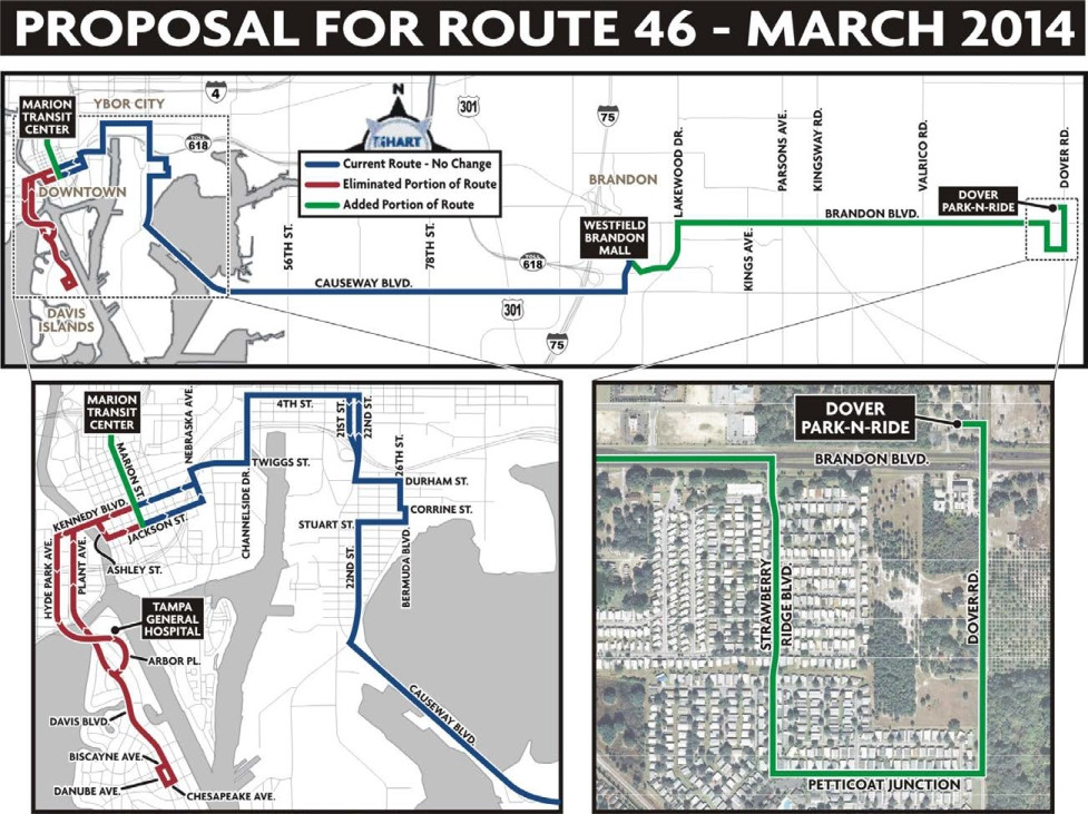
NOTE: The Petticoat Junction “jog” was not implemented in the final plan.

I think the Dover leg should be a separate route not an extension. I also have thought for a while that the Brandon area needs it’s own service. It’s large enough and I believe there is enough demand for it to succeed.
I agree with your points Jason. However, I’m pretty sure that there’s underlying financial and political reasons behind the Brandon area not having more transit service than it currently does. I’m also sure it’s these same elements that are behind why Plant City has largely abandoned its transit links.